Verdanterra Adds UAV Services to In-House Capabilities
To grow with the evolving needs of our clients’ and the energy industry, Verdanterra has recently added UAV or Unmanned Aerial Vehicle Services to our in-house capabilities.
Leading this new service line is Logan Hintze, former owner of Uplift Industrial Drone Services and FAA Certified UAS Remote Pilot. Logan joined Verdanterra in April of 2019 and brings over six years of experience working for industrial clients in the Oil & Gas, Renewable Energy, and Commercial Construction sectors.
Why UAVs?
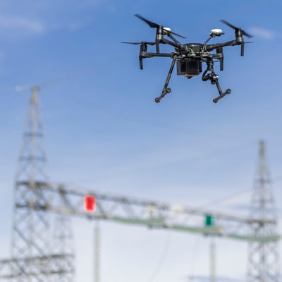
UAV field operations provide rapid data collection with high levels of accuracy. These systems’ capabilities are transforming the commercial and heavy industry sectors’ ability to design, plan, and execute projects. UAVs also can be utilized to efficiently monitor and inspect existing assets, such as operating pipeline rights-of-way, wind turbine blade conditions, or environmental restoration/mitigation sites.
Many of our energy clients rely heavily on accurate field data when developing, constructing, and maintaining well sites and gathering systems. UAV systems can provide “real time” site mapping and aerial inspection data. These systems can be paired with survey-grade site controls to plan, design, construct, and document remote land development operations.
Additionally, our web-hosted and fully automated post processing applications significantly cut the delivery time to our clients – we have the ability to provide processed data on the same day the UAV field data was collected. This delivery and collaboration method can improve our clients’ workflows and contractor management.
Improving Safety Using UAVs
Safety is Verdanterra’s highest priority. We are proud of our safety record, and we strive to reduce potential risks throughout our involvement in projects. Safety risks are present whenever field hours are involved. UAVs simply reduce both the type and extent of risk exposure for field staff. Large acreage projects and operations can be mapped and paired with aerial inspection data in a matter of hours, versus conventional methods which could take a number of days or weeks, exposing field staff to safety hazards. With the right project, UAV operations can drastically cut field exposure time, and nearly eliminate the need to traverse rough and unstable terrain when collecting data.
Verdanterra
Verdanterra is a consulting firm driven by innovative professionals in the environmental, regulatory, land survey, and engineering disciplines who are committed to providing exceptional customer service. Our company offers responsive and cost-effective solutions created by experts who understand the changing demands of the energy industry.
Recent news
- Verdanterra Expands with Land and Right of Way Services
- Verdanterra's Expanding Renewables Team
- Thinking Outside the Box for Oil & Gas Projects
- We are hiring!
- Verdanterra Celebrates Another Year Incident Free
- It's Official - We've Moved!
- Welcome A.J. Bonazzoli to the Verdanterra Team!
- Verdanterra Adds UAV Services to In-House Capabilities
- Celebrating Five Years of Success
- Growing our team