GIS and Data Management
Supporting assessment and infrastructure planning with GIS calculated impacts, desktop analysis, and spatial statistics.
Verdanterra understands the importance of GIS for environmental, land survey, and engineering projects of all sizes and scopes. We have years of experience in managing GIS data and field collected environmental features, spatial analysis, and cartographic standards. We skillfully use GIS to calculate impacts, perform desktop analyses, and analyze spatial statistics that can support our client’s assessment needs.
Cartographic Expertise
Good maps communicate clearly and efficiently. Our clients and field staff need to quickly interpret important characteristics of a project area whether it involves miles of corridor or only a few acres of impact assessment. Clear, simple, consistent, and informative maps are made with great care and only leave our office when they have been thoroughly reviewed.
Data Management
Verdanterra has extensive experience in managing large data which is critical to many environmental assessment projects. We help ensure our client’s data stays secure, reviewed, and organized. During most field seasons, our staff collect hundreds of features across miles of a given project corridor, making it imperative that the data collected is stored, managed, and analyzed efficiently to support project needs.
Analysis
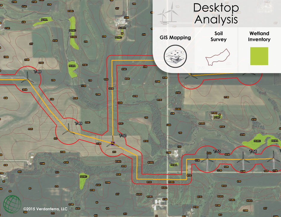
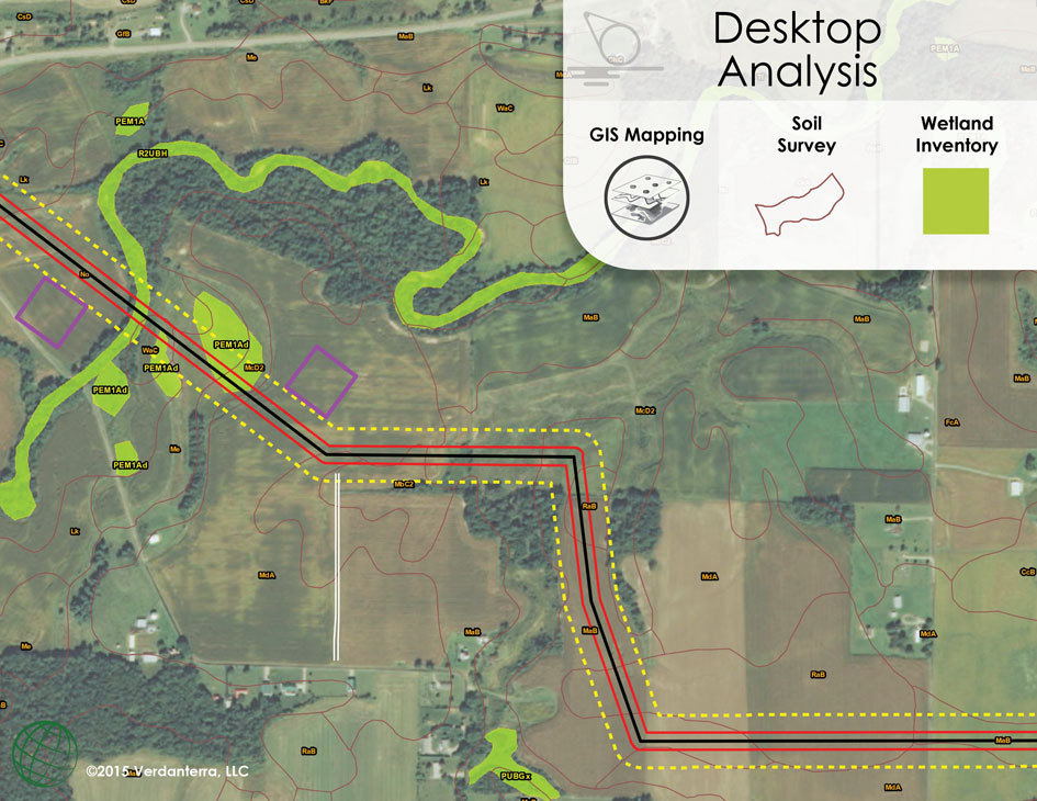
GIS is a powerful tool that allows Verdanterra to approach our client’s projects in innovative ways. From using spatial models to analyze potential steep slope prone areas along a project corridor, to an environmental desktop assessment used during routing and siting, Verdanterra has decades of experience using GIS to solve problems.
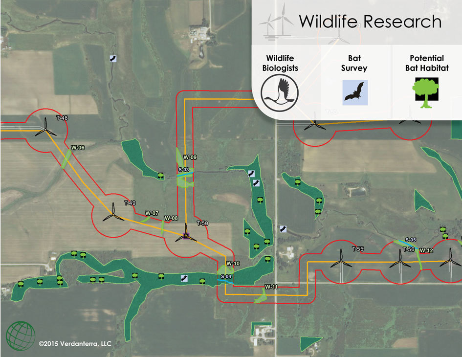
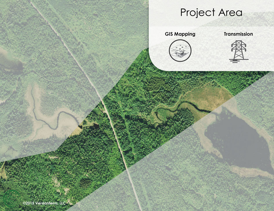
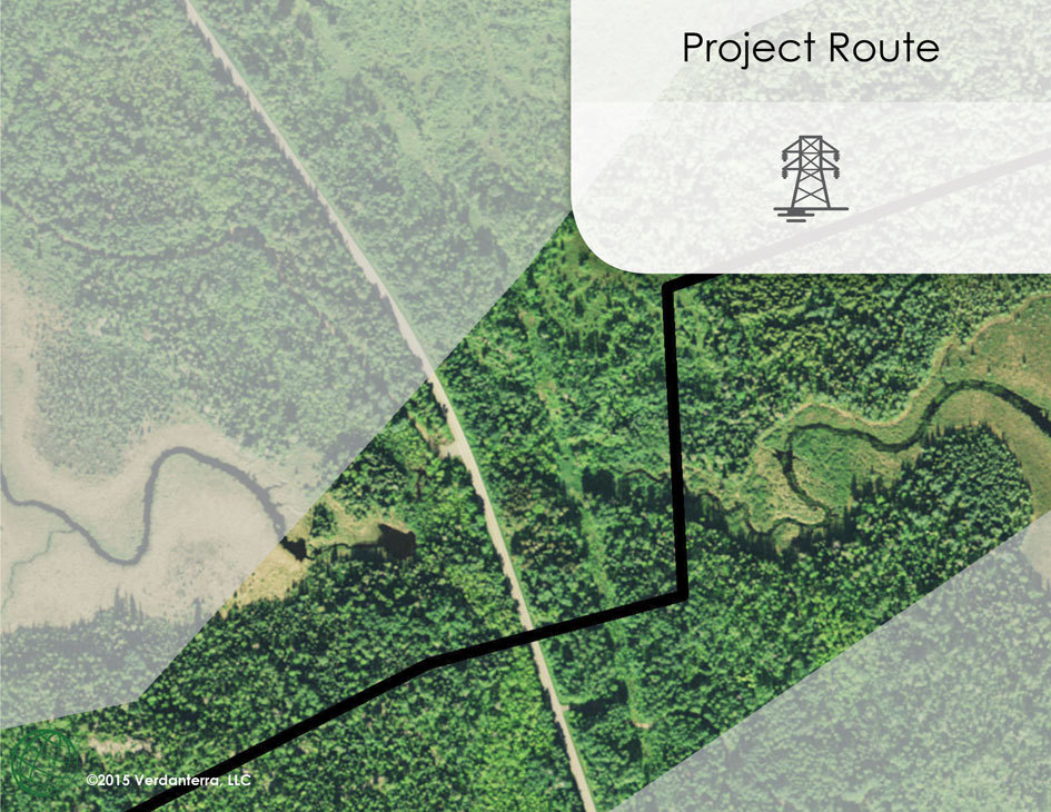
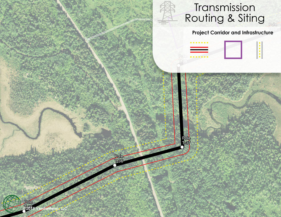
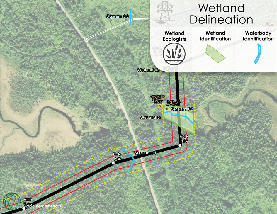
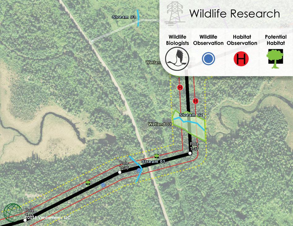
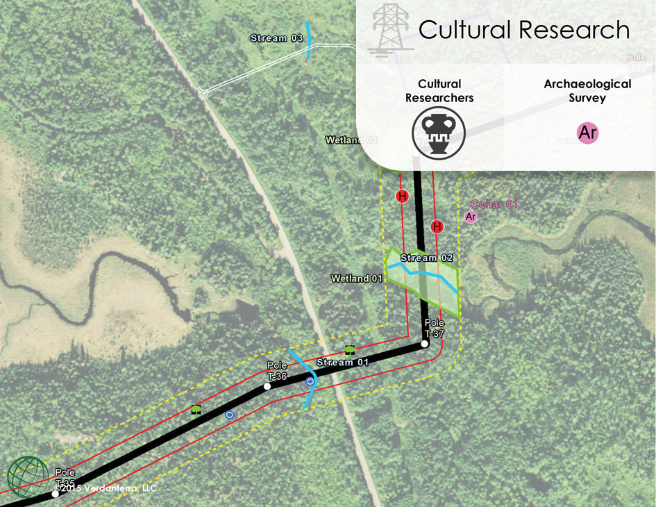
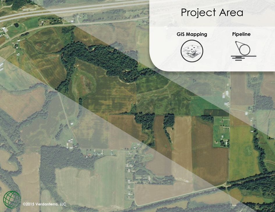
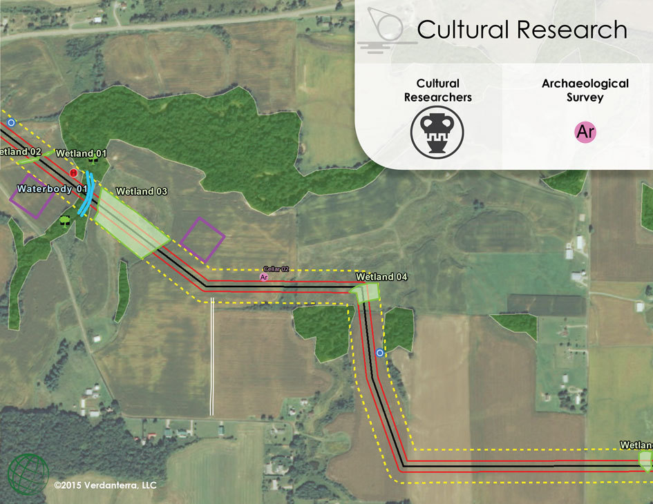
GIS Data Visualization
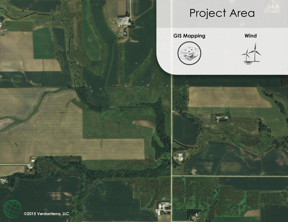
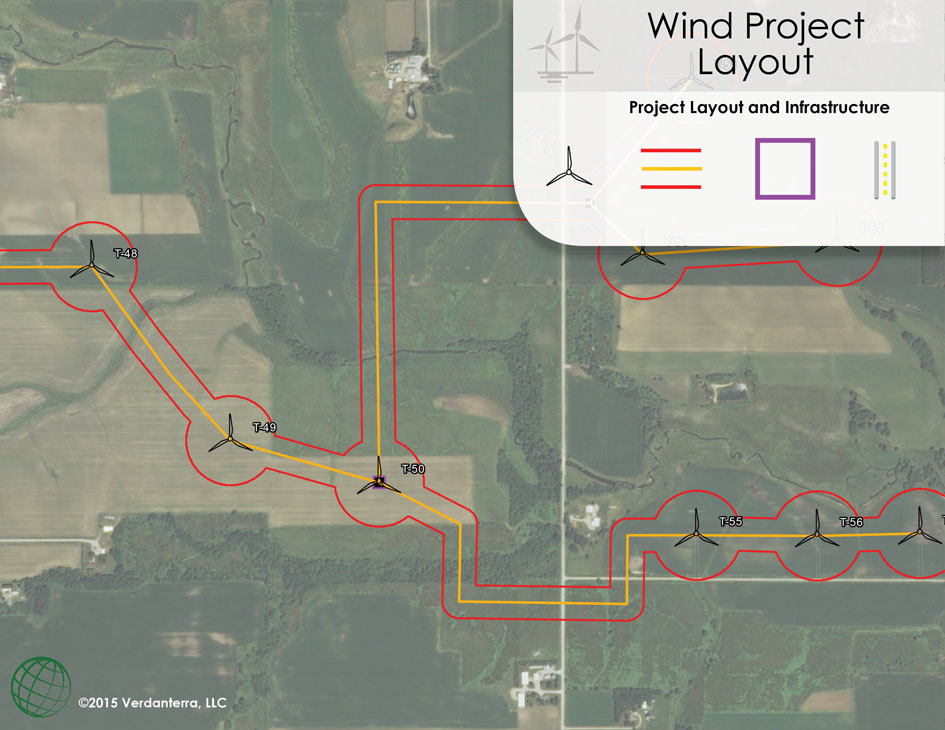
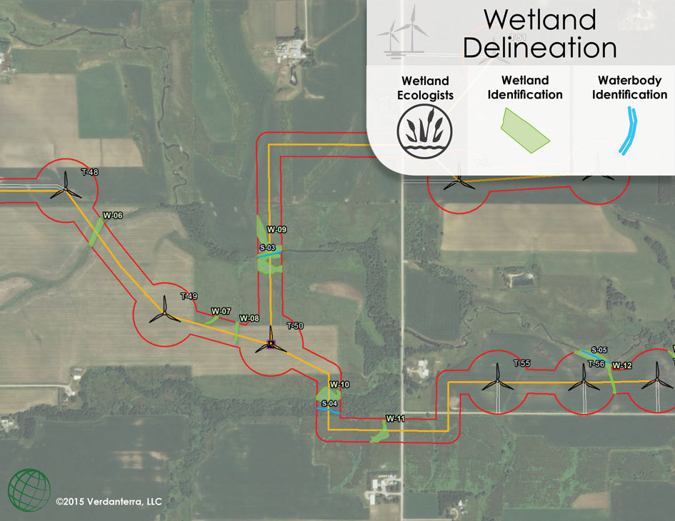
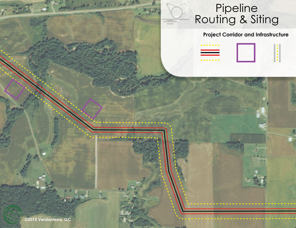
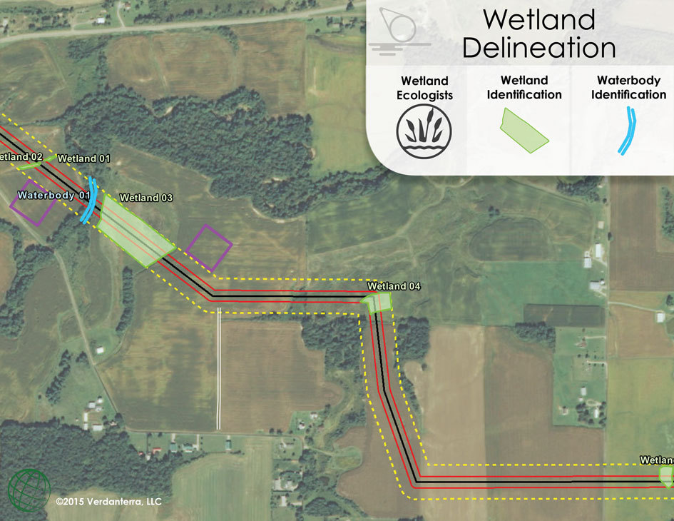
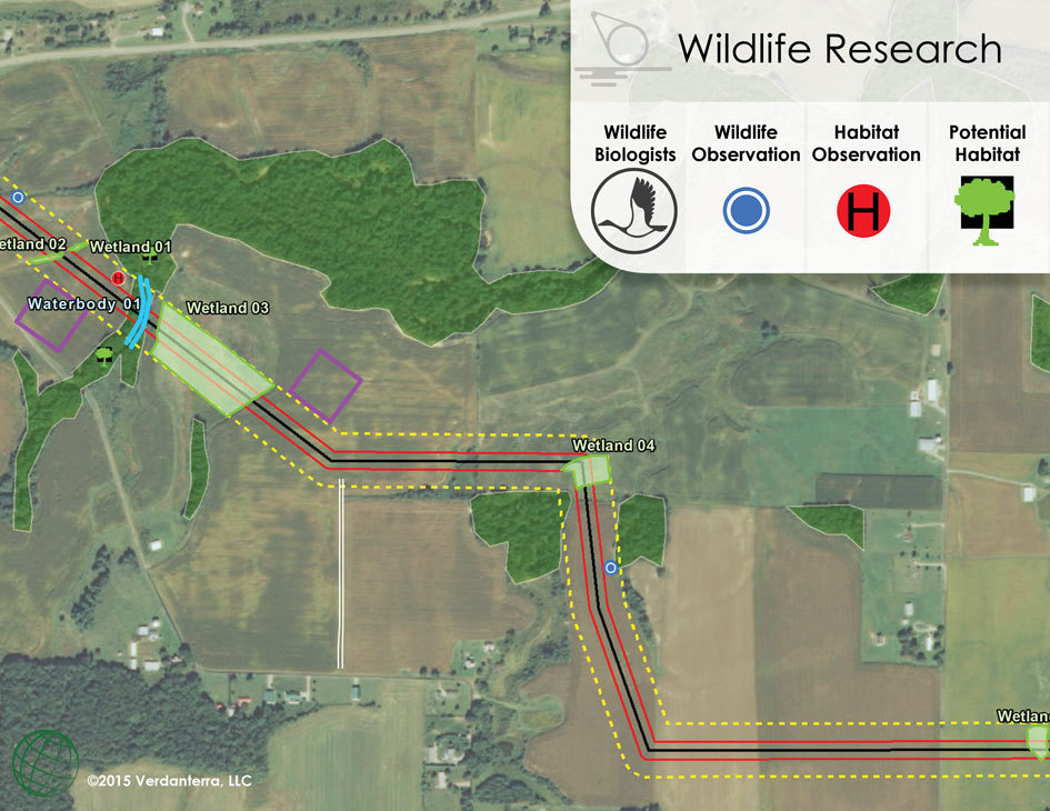
When developing or expanding power, oil & gas, or transportation corridors, having sound spatial data that measures potential impacts to the environment and surrounding features is critical for the permitting process. The below data visualization takes you through the steps of how GIS is used to help our clients and regulatory staff assess impacts of a potential project.
GIS Data Visualization


Want more information on this capability? Contact:
Andy Selk, GISP
Email: aselk@verdanterra.com
Ph: (608) 467-0279
GIS Project Experience